Section 7, Appalachian Trail
from: Boiling Springs, 1,066.7 miles to Katahdin
to: Deleware Water Gap National Recreation Area Visitors Center, 1,284.7 miles from Springer
July 1, 2010 to July 16, 2010
Section 7 miles: 173.1 miles

A note about the 7th leg of this journey—
In one word I can describe this 173 mile stretch—brutal. I describe it this way because the first week was during a record heat wave followed by a second week of random downpours.
About 55 miles into the hike I realized I had to get off the trail. I was experiencing weakness that I had never had before and did not really know what to attribute it to other than just getting older. However, when watching the weather channel at the Quality Inn in Lickdale I learned that I was smack in the middle of a record heat wave. A combination of temperatures and humidity so high that they had never been surpassed in the 200 year history of the area. Other through hikers had also pulled off the trail and were cutting back on their daily milage which is usually 15 plus miles at a minimum and will often get into the high 20’s. I rehydrated myself in Lickdale, reprovisioned and was able to set out up the Swatara Gap (I did have a zero day in Lickdale) in the very early morning and was able to make good mileage from that point on.
At Port Clinton I had a wonderful stay at the hotel there. Not that the hotel was any good (it is a dump) but that the bar was memorable. Coming in off the trail and having a cold draft was wonderful (and then a few more). I ordered a hot beef sandwich and it was served on a platter. Just what I needed. Unfortunately when attempting to leave in the early morning I was caught in a downpour. This set me back a couple of hours and I left in a light sprinkle but once again made good time. But this is where I made my big error for this 7th leg. I left my spare socks in the hotel!. By the time I reached Delaware Water Gap my feet were in pretty poor condition given the combination of wet socks and intermittent rains.
What follows are the details—
July 1—Boiling Springs to Pa. 641
1115.7 miles from Springer
4.1 miles
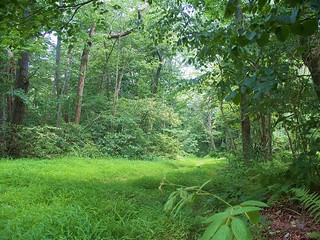
Well, it’s um Thursday, July 1, 2010, my first day on the trail. I left San Antonio early in the morning. The flight of course was long and arduous and the shuttle drive from Philadelphia seemed to take forever to get me into Boiling Springs. But once there I had a quick dinner at the Ristorante and Pizzeria there in town and then took off on the Appalachian. I took off about 6:30 and right now it is about 8:45. I am very close to the Pennsylvania turnpike HY 76. It’s farmland, very easy hiking so far, which is nice since I’m just starting out. I found a nice secluded place, right by the trail, um, some nice grass to set up my tent on. You can hear the birds in the background there. And, uh, it’s just now starting to get dark. I hope to get in a chapter or so of the Poisonwood Bible that Vivian loaned me. And, uh, I’ve had dinner already and I’m ready for tomorrow. So that’s it for today.
July 2—to Cove Mountain Shelter
1133.2 miles from Springer
17.5 miles
It’s Friday, July 2. I hiked today to Cove Mountain Shelter (coughing). Excuse me. According to my GPS it’s about 14.4 miles. That’s a pretty full day for the first day on the trail but I did take rests and read from the book Vivian gave me, The Poisonwood Bible, which is a really interesting book and I was able to stop and read that along the trail. And so I’m tired but I feel pretty good. Right now I’m cooking dinner and you can hear the background with Pocket Rocket noise going there. I’m going to try mash potatoes with green beans and tuna. I think it should be OK. I’m going to try cooking just a half bag of the mashed potatoes because I’ve only got the one cup. That might work. I’ve got plenty of water. Tomorrow is a, ah, I’m not really sure how far I’ll get tomorrow. I’ll probably will go to the small town of Duncannon, the Appalachian Trail passes right through it. I’ll probably eat there and replenish a few things. And then there’s a motel just outside the town right before the climb. I might just stay in the motel and take an easy day tomorrow and then be all primed for the climb out the following day. Anyway, everything changes from day to day. So, that’s it for tonight.
July 3—to Peters Mountain Shelter
1148.6 miles from Springer
15.4 miles
July 4—to Stony Mountain (approximate)
1158.1 miles from Springer
9.5 miles
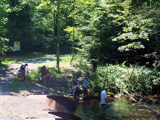
It’s July 4, about 8:00 in the morning. I’m taking a rest break just north of the Peters Shelter, that’s where I stayed last night. Yesterday was kind of a long hike. It was about 13 and 1/2 miles. I hiked through Duncannon from the Cove Mountain shelter and crossed the Susquehanna River and stayed at the Peters Mountain Shelter last night. Quite a group of people on the trail here. It looks like this is where the through hikers are pretty much now, so I’d say there are 8 or 10 other hikers that I’ll see every once in a while along the trail. I’m not sure where I’m going to get today. The next shelter is about 18 miles away and that’s about 16 miles from where I’m sitting, so that’s quite a hike. I doubt I’ll get that far. In fact I don’t even want to try it because it’s so far. Um, so probably around 12 miles or so I’ll start looking for a place to camp out. I’ll check in then.
Well it’s the end of the day on July 4. I put up a campsite about 7 miles from, from Rausch Gap shelter. This was as far as I could come. The heat was sweltering. It was very difficult hiking today. I’m in my tent now. I have no hunger at all but I know I should eat something. Um, and I have to drink something. But just tired. So, we’ll see what tomorrow brings.
July 5—to Swatara Gap
1172.1 miles from Springer
14 miles
Today is July 5th. It is about 3:00 in the afternoon. I am within a mile of Swatara Gap and that is where I plan to stop. Um, I’m going to try to catch a ride into town. I think Lickdale is the name of the place. It is about 2.6 miles down the road. I’ll either hitchhike or get in somehow. There’s a motel there, I’ll get cleaned up. That’s the plan anyway. Get some junk food and replenish and then hit the trail again tomorrow. I will have done about 12 miles today, which I’m thrilled with. Um, once again it’s a hot day and it’s exhausting when I’m going up the hill. Especially today’s hike wasn’t much uphill so that was fortunate for me. Some people I’ve met on the trail, um, just some names so I don’t forget them—Red Lobster, Serenatina, Red Stick. Let me start over. Red Lobster is from Massachuttsetts, these are all through hikers. Serenatina is from Florida, Uh Red Stick born in Venezuela, lives in Miami now. Powder, he was hiking with his dog Russell, London Joe. Of course he’s from London. Wood Grappler and I might think of some others later but I wanted to get those names down before I forgot. So I should be finishing up here pretty quickly. Take care.
July 7—to Round Head, Shower Steps
1186.6 miles from Springer
14.5 miles
It’s July 7, um, 2010. Let’s see what day that is. Be Wednesday. I started this morning at Swatara Gap and I pulled up about 13 1/2 miles north of there. It’s been a good day. I got started right at 5:00 so I was able to do the climbing in the cool part of the day and pretty much it’s table top walking from then on. Except the terrain does get rocky and some places very rocky in spots and I hear it is only going to get worse. At the 501 shelter I was able to order a sandwich and some coke so I’m going to finish that for dinner tonight. Just take off and go to bed. So, I’ll report tomorrow. Oh, by the way, I had a one day zero day in Lickdale just to kind of recover and that really helped a lot. So I think I’ve kind of got the idea now. You do all your hiking before 12 and than you take a break. And then you do a little after 4. It’s been very, very hot. See you tomorrow.
July 8—to Shartlesville Cross-Mountain Road
1200.5 miles from Springer
13.9 miles
July 9—to Port Clinton
1207.2 miles from Springer
6.7 miles
It’s Friday, July 9th, about 7:19 in the morning. I’m about 5 miles outside of Port Clinton. I’ll probably stay in Port Clinton overnight. Met a trail person, Beaver Chief, from New York, Rochester area, he’s a snowboarder, young kid, he’s gone ahead now. Um, and then yesterday I met another trail person called Second Shift, um he was from Massachuttsetts, younger person, I’m not sure what he did. He looked like he may have been Indian. He was very concerned about water which makes a lot of sense. I’ve got about 3/4 liter but I’m only five miles from home. I think there is a spring up ahead, so we’ll see how things go. Um, that’s about it.
July 10—to Eckville Shelter
1222.4 miles from Springer
15.2 miles
July 11—to Bake Oven Knob Shelter
1239.8 miles from Springer
17.4 miles
July 12—to Lehigh Gap
1247.2 miles from Springer
7.4 miles
Okay, it’s July 12th. I’m in Slatingham. I made a, kind of a long run. I did 15 miles and then 17 miles or something and then like a 7 mile run into Slatington where I’m staying at kind of a dump, really. Slatington is kind of weird. It’s uh obviously very historical. But they have all these old buildings and I’m staying in one of them on the third floor and they’re just literally falling apart but people are living here and it seems normal and I really don’t know what else to say about it except that it really is a strange feeling to walk through this place. Very different part of America that I’ve never seen before.
I’ve got one more run to do it looks like to get to Delaware Gap. I’m only 36 or 37 miles away so there’s not a question of being able to complete this now. It’s just Monday and I don’t have to be in Delaware Gap til Saturday and to do 33 miles, I mean, I’m going to go to a shelter and then another shelter and then it’s a walk-in to Delaware Gap. So that would be Tuesday, Wednesday, I should come in Thursday. Um, that’s about all I’ll say for now. The weather has been um cooler since the rain that we had, and I see now and from the weather channel it says it probably is going to rain tonight and early tomorrow morning there will probably be a bit of rain so I’ll probably have some rain to deal with over the next two days um, which shouldn’t be a big deal. So, um, the rocks are, you know the famous Pennsylvania rocks and uh at times your’e climbing over boulders and looking for the path. But it hasn’t been anything that’s really slowed me down. I seem to move at a fairly constant pace. So doing 15 miles or 17 miles doesn’t seem to be an issue. Now tomorrow I should do 16 to stay at the Smith shelter. That’s my goal. So I’ll sign off for now.
July 13—to Leroy A. Smith Shelter
1263.4 miles from Springer
16.2 miles
(No audio) The high point of the run from Port Clinton to where I am now, which is where? Ah, Lehigh Gap. Um, On Highway 309 the Appalachian Trail crosses there right at the Blue Mountain Restaurant. And I got off and had a nice lunch there and got some food to go. I ate with Commander Chief who is a retired navy person. He’s 56 years old and a through-hiker. And I also had lunch there with Flaco, and he’s a through-hiker. Both very interesting fellows. And that was the high point of this last jag.
July 14—to Kirkridge Shelter
1277.2 miles from Springer
13.8 miles
It’s July 14, 2010. I’m sitting in the Kirkridge shelter. I’m just about 7 miles outside of Delaware Water Gap so you can see this is pretty much winding up the seventh section of the Appalachian Trail for me. The last two days have been brutal and that’s leaving Slatington or what you would call Lehigh Gap. And that’s where the rocks were. Um, we’ve been hearing about the rocks in Pennsylvania and just outside of Lehigh gap as you climb out you hit them. And they’re huge boulders that you have to clambor over and climb pretty much straight up. But, the good thing is just being careful and looking for the footholds and such it was almost like going up a flight of stairs. That was bookended by some rocks today at, they’re called Wolf Rocks. And I went through those about 2 miles back. A little more then 2 miles back I hit the Wolf Rocks. Those were a little more dangerous I feel because it was raining on and off all day today and the moss on the rocks gets really slippery. I had to be exceedingly careful going down the Wolf Rocks to make sure I didn’t slip. Very dangerous and very steep. But, um, I made it to the Kirkridge shelter all in one piece and it looks like about 7 miles to go. And I don’t anticipate any problems tomorrow. It should be a great day coming into Delaware Water Gap. So that concludes what I have to say for today.
July 15—to Delaware Water Gap
1283.6 miles from Springer
6.4 miles
July 16—to Delaware Water Gap National Recreation Area Visitors Center
1284.7 miles from Springer
1.1 miles
