It has been two months now, since Vivian and I summited Katahdin. This was my last day of a 12 year journey on the Appalachian Trail and, just to make things interesting, I underestimated what we were getting into.

This final section hike began at Caratunk, June 28, 2015 and was divided into 3 parts: Caratunk to Monson, the 100 Mile Wilderness, and Katahdin. When I exited the 100 mile wilderness we had planned for 2 days to complete the hike. The first day Hedy and I would hike from Abol Bridge to the Katahdin Stream Campground (about 9.9 miles) and the final day Hedy, Vivian and I would hike 5.2 miles to the summit and then return by the same route.
We left Millinocket at 5:30 sharp on the morning of the 14th. The drive to Baxter State Park (south gate) is 17 miles over a paved, local road. Once inside the park the road narrows to a graveled road with speed limit 20 mph. In another 7 miles we reached Katahdin Stream Campground (1080 feet) where public parking is available for day hikes.
We began our final summit hike at 6:40 am, July 14, 2015.
I had done no prior reading about Katahdin and only had the impressions from Map 1 of the Official Map and Guide to the Appalachian Trail in Maine. According to the topographic map the climb was going to be a steep one but I had been on other steep climbs. I made the assumption that since Katahdin was the northern terminus of the AT, that it is a well known and popular trail, that the steep grade would be taken care of by a series of switchbacks and stone stairs. I do not know where this idea came from but I do know that you should never underestimate the trail. But in this instance, I did.
The three of us started out from the campground parking area at about 6:45. In 40 minutes we had covered 1 mile and were lulled into a sense of “this isn’t bad at all”. Just 4.1 miles to the summit and the end of my AT journey.
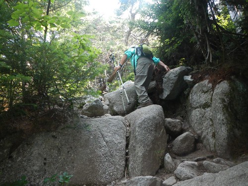
But the trail began to ascend more steeply. After another mile we began to negotiate larger rocks and a painfully-slow problem solving process to move forward. Vivian left Hedy and I and headed for the tree line at about 3500 feet and waited for us. We would not join up with her until 11:15 am.
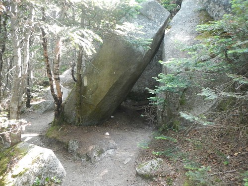
At 10:36 Hedy and I reached The Cave-described in the map as a “small, slab cave”. We were not making good time.
We had 2.5 miles to go. It had taken us almost 4 hours to get to The Cave and we could only surmise that the trail ahead would not get better.
When we joined Vivian, Hedy sent the two of us ahead to finish. She realized that we would arrive very late in the afternoon if she continued the ascent with us. Vivian and I were nervous about leaving Hedy but there were a number of other hikers coming and going and we really had no choice for me to complete the AT. Just 2.5 miles to the prize!
We continued above the tree line through a boulder field. There is no trail, only white blazes to guide the way. At 12:15 pm Vivian and I reached the 2 mile mark. We could see the False Summit” and at 1:10 we reached it. Vivian and I had been told about the False Summit by a hiker named Kyle at the Bald Mountain Brook Lean-to, a couple of weeks earlier. He had some great photos he shared with me and warned me about the False Summit”. It appeared to him, and his fellow hikers, that they were approaching the real summit only to find that they would still have another 1.6 miles to go. As you climb toward the summit you can clearly see a sign that adds to the impression that the real summit, the end of the AT, is at hand. However, the sign only warns hikers to stick to the trail and the actual summit can be viewed in the distance..
The False Summit actually turned out to be The Gateway and was clearly marked on our map. We were now 1.6 miles from the actual summit. The nice surprise−we were at the edge of The Tableland. We would have relatively level hiking for about 1 mile before beginning the final ascent to Katahdin.

At the 1.0 mile mark we reached Thoreau Spring (4627 feet). Several hikers who had passed us earlier in the day stopped to chat with us on their return from the summit and congratulate me for being so close to completion. Vivian and I had been leapfrogging with a youth group starting from Antlers Campsite (about 50 miles south). They stopped on their return trip from the summit and congratulated me. It was gratifying to have these folks recognize the accomplishment. Vivian and I continued on. We could see the summit now and the white blazes leading the way.
At 2:27 pm we summited.
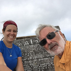
We did not stay long, just under 15 minutes. We took a few photos. There were perhaps 15 to 20 people at the summit. We were anxious to get back to Hedy and off the mountain and as we descended to Thoreau Springs a cloud cover engulfed the summit and a strong wind began to blow. We soldiered on. At The Gateway we descended into the boulder field and had to navigate carefully and slowly. Views were spectacular. We found ourselves “waiting in line” at a couple of bottle necks just above the tree line.
Once we hit the tree line we had a trail again, although covered in boulders so the going was slow. Below The Cave the trail continued to improve as we could follow stone steps now, for the most part. At 6:20 pm we reunited with Hedy. She had not waited for us but had continued to climb and had actually reached the False Summit before turning back. We were very proud of her, and her efforts this day were inspiring. Hedy is tough.
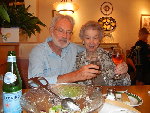
We were still about 2 miles from the parking lot. Hedy and Vivian wanted to celebrate our reunion by eating dinner. We had a Greek salad. I was very uncomfortable sitting. During the 100 mile wilderness I had two hard falls and was feeling the effects. One fall was a pratfall. Nothing pretty about that. But, as I sit at my MacBook and compose this posting, I can still feel the effects on my tailbone. Very slow to heal. The other fall was on my right side, hitting the ground hard. My pack absorbed most of the blow but there was an exposed tree root that punched me in the side like a fist. This caused problems sleeping in the tent as I could barely turn from my right side to my back to my left side and repeat. This is my normal “sleeping procedure”. This “punch” continued to linger with me for the remainder of the hike. Because I was so uncomfortable, Hedy and Vivian sent me on ahead to the parking area. I arrived about 7:30. It would not be until 8:30 that Vivian and Hedy would arrive. That makes for a 14 hour day! Hedy and I were completely exhausted from the day, Vivian was not. She walked with her mom and encouraged her along the way. Vivian is tough.
