Posted on

151.3 to Katahdin

Saturday, July 19, I arrived back from my 11th year on the Appalachian Trail. Going into this section I did not know how difficult it was going to be. I had hoped that I had the worst behind me but actually this section was harder than last year’s. The hike began at the summit of Mount Washington on June 26, about 9:00 am. Hedy and I arrived in Portland the day before, picked up our rental car, and then found HQ in Gorham, NH. It rained the entire day and well into the evening. I was uncertain if I would be able to set off on the morning of the 26th but the weather had cleared and we were the first ones to enter the auto road for Mount Washington.

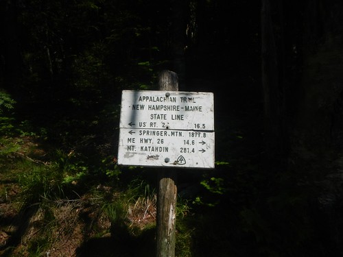
The starting point was 332.5 miles from Katahdin. I crossed into Maine in the early morning of July 2 (281.4 mile mark) and stopped at Caratunk, Maine, July 17 (151.3 mile mark).

Appalachian Trail 2014
New Hampshire/Maine state line, on the Mahoosuc Trail, on the AT.

Every day was a tough hiking day. I took a zero day after perhaps the most difficult stretch of hiking in my life. This was the final New Hampshire section (HY 2) to Grafton Notch in Maine. This stretch was 31 miles and I divided it into hikes of 12, 9 and 9. The last hike included Mahoosuc Notch, Mahoosuc Arm and Speck Mountain. I was exhausted when I exited the trail and thankfully it rained all night and the next day and gave me a perfect excuse for a zero day. This was July 4th. I took a second zero day on July 8th. I had broken my pinkie on my left hand on the first day hiking (Mount Washington) and Hedy and I drove into Rumford, Maine to have it checked. We picked up Vivian and Andrew at the Portland Airport that evening so it seemed like another good excuse for a zero day. Other than that, it was hiking every day. Most of it very challenging.

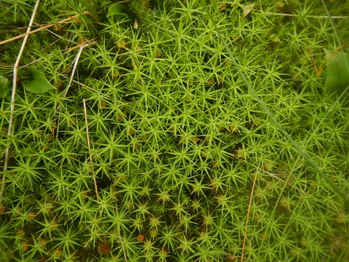
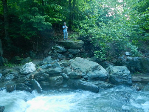
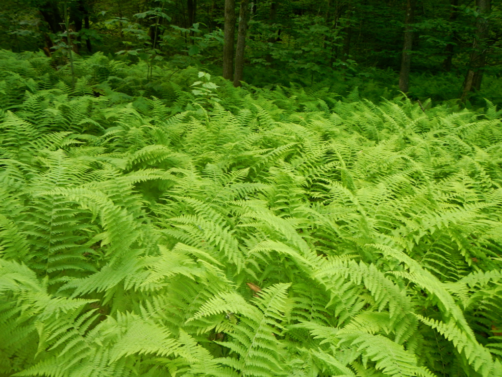
Like last year I found that while the trail was extremely difficult that the experience and beauty offset that. This was my best section yet, even better than last year. I am nicely positioned to complete the AT next year, which was my goal. Over the next few weeks I will be working on my page providing details of this 11th year and uploading photos.


Posted on

AT 2013 Posted…

From June 30th to July 15th Hedy and I explored new territories, experienced adventure and created memories. This was my 10th year hiking on the Appalachian Trail and it was easily the most rewarding one. This section began  at Stony Brook in Vermont and is approached by a rough access road. Fortunately we had a local map with a place listed on it called Notown. It does not show on the official AT map but is very close to the marked parking area. Notown happened to be in our Tom Tom  so we were able to arrive without problems and get off to a quick start.

Appalachian Trail 2013
Common hairmoss (Polytrichum commune).

The posted page for AT 2013 details the hike. I did better documenting this section then any of the previous 9 hikes. Photos are posted in Flickr and some thumbnails appear in daily entries—just to provide a flavor for the hike.

July 15th I arrived at the summit of Mount Washington. That is where I will begin the AT2014. I will try to squeeze out a few extra days for the 2014 hike. Once I hit the White Mountains things really changed—the trail was so difficult there were days I only managed 8 to 10 miles. The views were spectacular and other-worldly, especially above the tree line. I rued having to stop at Mount Washington. Four more days I could have completed the Whites and been at the border with Maine. I had a rhythm established, my confidence was high, Hedy and I were working well together in planning pick up and drop off points. I was a good 40 miles below my expectations for this hike due to the Whites. Looking ahead, 332 miles to Katahdin, I don’t really see much relief—no easy days that’s for sure. So, divide 332 by 10 and that’s 33 more days on the trail. I really need to get well into Maine in 2014 to complete this in 2015.

Posted on

AT 2013

I’m back from my 10th year of section hiking the AT. This has got to be my favorite one. Right now I am working on the photos and have a new account with Flickr that I am familiarizing myself with, so this will take a bit of time. Here is beginning of this 10th section hike—

Appalachian Trail 2013
Hedy is poised on the opposite bank of Stony Brook, my starting place for the 10th year of section hiking on the Appalachian Trail. This is Vermont, section 3, about 477 miles from Katahdin. Although the official AT map shows a parking area, there is only a small place on a dirt road to leave a single car. There are no services nearby so this is not a good place to get off or on the trail. The bridge was washed out and I had to begin this section by fording Stony Brook which had a suprising flow of water. This marks the first day of my 10th year on the AT. Vermont, section 3, 477.3 miles to Katahdin.

Fortunately, Hedy and I marked the GPS coordinates of this position when we got off the trail last year. We headquarted at a Super 8  in White River Junction to begin this 10th section. I was concerned about finding our way beck to our Stony Brook exit but—no problem. Our TomTom took us to the exact spot we had left off at. Trip report of. this section hike are posted at https://gravelboy.edublogs.org/at/at-2013-vt-n-h/

Posted on

AT 2012-we’re back…

Fern Forest, on the AT, near Mt. Everett, Mass.

Last July 17 I returned from the Appalachian Trail for 2012. This was a difficult section on par with my first hike on the Royal Arch in the Grand Canyon. After both hikes I was “hiked out”. Hopefully I’ll get back to Government Canyon this coming weekend.

I’ve begun work on the photos for the AT 2012 page I will eventually post on this blog. I began the hike at Conn 41 just outside Salisbury, Conn at mile 689.7 from Katahdin. Hedy and Nata joined me for the beginning of most of the day’s hikes. Nata hiked with me for one week before she had to return to San Antonio.

I concluded this 9th section hike at Stony Brook where there is an access road with a small pull off area for the car. This is fairly close to Killington, Vermont. My Appalachian Trail Thru-Hikers’ Companion does not have a mileage marker for this although it is a prominent parking pick up on their official maps. The Stony Brook Shelter is about 1 mile from this point and that is listed at 477.9 miles to Katahdin, so I will use that figure to conclude the 9th section hike.

The total miles covered for the 9th section is 211.1 miles. That is my best to date. However, it has come at a price as I returned exhausted and had to jump back into work immediately. It was nice to be able to hike with Nataly on several extended hikes and it was great to start the hike with Hedy who provided excellent support and shuttling. Stony Brook parking area is about 35 miles from the Vermont-New Hampshire border. That means most of my 10th section hike, God willing, will be in New Hampshire. The AT goes through New Hampshire for 161 miles. I should get quite close to the Maine border next year but might not make it. It will be difficult to maintain the pace I had for the 8th and 9th sections. However, with Hedy coming and doing the shuttling it does provide me with opportunity to increase my mileage which is so important now. I would really like to finish this.